President Biden Signs Long-Awaited MAPLand Act Into Law
The MAPLand act will open up 16.4 million previously inaccessible acres of public land. President Biden signed it into law today.
Thanks to a broad pool of lawmakers, conservationists, and activists, Americans will soon have easier access to far more public land.
The Modernizing Access to Our Public Land (MAPLand) Act will shore up and digitize public land maps for the benefit of all users. In a nutshell, the act gives visitors viable maps of public easements that allow access to public land surrounded by private land.
These maps will further clarify where access does and doesn’t exist for the public, and they will likely point out some easements that were previously unknown. This information will also serve as a guide for future access projects and potential acquisitions that may create more access.
And it’s worth noting that the outdoor mapping brand onX Hunt partnered with the Theodore Roosevelt Conservation Partnership to initially inspire and endorse this bill. OnX’s effort to highlight landlocked public land is ongoing, and the MAPLand Act looks to digitize and modernize the information surrounding much of these public lands.
The MAPLand Act garnered widespread support in Congress. After a near-unanimous House vote, it breezed through the Senate on April 6 unanimously. President Biden signed it into law on April 29.
What the MAPLand Act Will Do

The $32.5 million initiative seeks to solve a widespread access issue. In the case of the 16.4 million acres the plan addresses, legal access often requires a patchwork approach of understanding regulations, researching private property boundaries, and aggregating multiple maps from various sources.
Sometimes, the map you need might not even exist. Before the MAPLand Act, digitized maps existed for only 5,000 of the country’s known 37,000 public easements.
The law seeks to provide the missing links to a range of public land users as well as a lot more information. Whether you hike, bike, hunt, fish, camp, or climb, it’s important to know what you are and aren’t allowed to do on a specific parcel of land. Some lands are off-limits to shooting and hunting; on others, motor vehicles are banned.
The MAPLand Act will make it easy for visitors to access such use regulations, decreasing the chances of being fined.
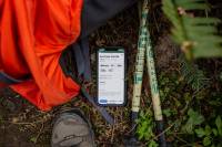
The guidelines and maps will post on the U.S. Department of the Interior, Forest Service, or Army Corps of Engineers website as applicable. The data will also become a national digital public record, so websites and apps like onX or Strava can make it available for free.
In addition to maps, the full rundown on guideline resources includes the following:
- Status information on road and trail closures
- Seasonal closure dates for roads and trails
- The classes of vehicles and types of recreational uses that are allowed on each segment of roads and trails on the Federal land, including the permissibility of
- Off-highway vehicles
- Motorcycles
- Bikes and e-bikes
- Passenger vehicles
- Snow vehicles
- The boundaries of areas where hunting or recreational shooting (including archery, firearm discharge, and target shooting) is regulated or closed.
The funding will disperse in stages throughout 2025. Backcountry Hunters & Anglers President and CEO Land Tawney commented on the MAPLand Act’s success.
“In a political climate that can be characterized by partisan rancor and discord, passage of a fundamentally bipartisan effort is worth celebrating,” he said.
“Here’s to unity and shared values in the name of access to our public lands, and here’s to the MAPLand Act becoming law!”
The post President Biden Signs Long-Awaited MAPLand Act Into Law appeared first on GearJunkie.


